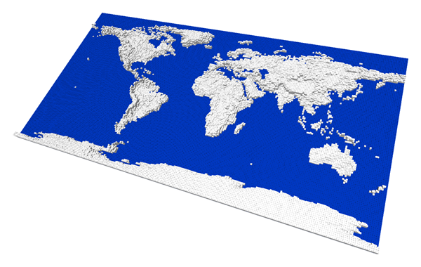
 One small thingy while collecting ideas and time for the next project: I've created a Lego world map Ldraw/MLCad (.LDR) file with altitudes, for a friend who's preparing a small geography fair and considers building one. For the case you might find some usage for it too, it's also available for download here.
It's a quite large map, 250x125 studs (2x1 meters, approx. 80"x40"), and the model consists of about 130 000 smallest plates stacked where necessary ― it's up to the builder to choose the most convenient reinforcements and substitutions with larger plates, bricks or columns. The altitudes are, of course, drastically out of scale, and there are two colours: white for the land and blue for the seas, as you can see on the rendered picture. It includes the Antarctica and some tiny ocean islands represented by just a single brick, but there should be no problem deleting them in MLCAD or any similar LDR editing application if necessary.


No comments:
Post a Comment